Click on each stone below to find out more about it, or follow the arrow above right to tour them all.
The date given above each stone the date it was erected, which is often a year or two after a boundary change.
The five marked with an asterisk and the two Hundred Stones at the end are Grade II listed structures.
1635*
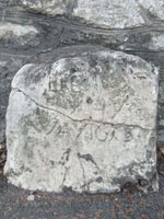
Foot of Rose Hill,
near Iffley Turn |
1667*
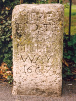
Warneford Lane,
near Cheney Lane |
1600s*
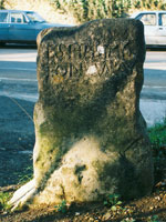
Bottom of Cuckoo Lane,
Headington
|
1684

Near Lower
Farm, Barton |
1729*

On Headington Hill,
just above the bridge |
1786*
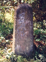
Freewater Stone,
near Long Bridges |
1832

Set in garden wall of
78 Banbury Road |
1837?

Cuckoo Lane,
south side |
1837

Cuckoo Lane,
north side |
1837

Godstow Road,
foot of toll bridge |
1837?
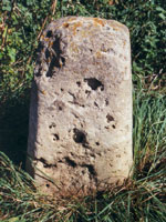
Barracks Lane
west end
|
1837?
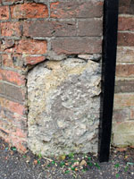
Henley Street
Junction with Iffley Road
|
1840

Set in the wall alongside
the Godstow Road |
1840
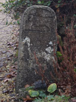
Private house next to
Godstow car park |
1840

Port Meadow,
near Burgess Field |
1841

Marston Meadows,
on private land |
1843
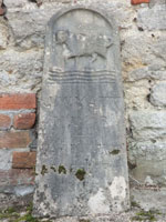
King’s Mill House,
Marston |
1843?
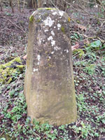
Barracks Lane
east end |
1886
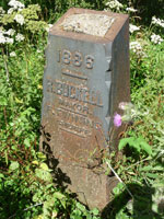
Private land
at Binsey |
1886
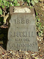
The Trout,
Lower Wolvercote |
1886

On Thames Path north
of Godstow Road |
1886
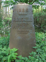
Marston Meadows,
near Rainbow Bridge |
1886

Port Meadow:
NW of Burgess Field |
1886
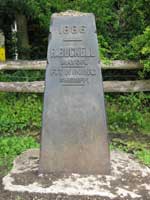
Near Godstow car park,
Port Meadow |
1892
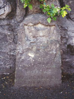
Opposite Headley Way,
Headington |
1892

Near Woodlands Road,
Headington |
1892
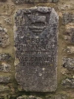
Bridge on Godstow
Road near Trout |
1892

Near former Sunnymead
bathing place |
1892

Oxford Canal, opposite
St Edward's sports field |
1892
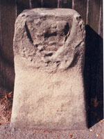
Woodstock Road, near
St Edward’s School |
1892

Hogacre
Common |
1892 (probably)

Port Meadow
north end |
1892

Iffley Meadows
near Donnington Bridge |
1892 (probably)
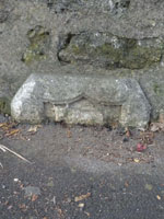
Hinksey Stream bridge,
Old Abingdon Road |
1899

Wolvercote Common/
Port Meadow (1) |
1899

Wolvercote Common/
Port Meadow (2) |
1901

Junction of Pullen's &
Cuckoo Lane |
1901
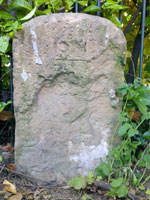
Crescent Road,
but no longer visible |
1901
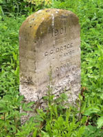
Private land near Willow Walk Bridge, North Hinksey |
1901

In the Oxford fields
opposite Victoria Arms
|
1984

The Fishes,
North Hinksey |

Near Thornhill
Park & Ride
|
There are more surviving boundary stones in Oxford
yet to be photographed
|
Other types of marker stone in Oxford |
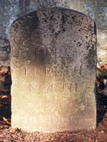
Hundred stone on west
side of Parks Road
|
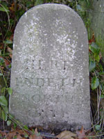
Hundred stone outside
42 St Giles's Street
|
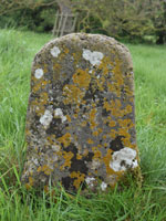
Conduit stone
at Raleigh Park
|
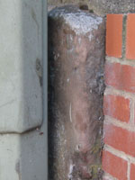
Parish stone in
St Clement’s Street
|
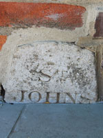
St John's College boundary stone in the Banbury Road
|
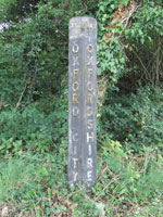
County boundary
on northern bypass
|
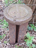
Railway
boundary markers
|
See also
Parish Boundary Marks
War Department Stones
Milestones |
Riding the Franchise
Not to be confused with Beating the Bounds, when churches on Ascension Day beat their parish boundaries
The Mayor of Oxford used to ride the franchise to inspect the city's boundary stones near the end of his year of office. Jackson's Oxford Journal observed on 12 September remarked that although making a circuit of the municipal franchise had become obsolete in many places, it was “evidently the most effective way of preventing litigation on questions of boundary”.
Following the Municipal Corporations Act of 1836, this was supposed to be done every third year, but the rule was not followed strictly, and when the city became larger at the end of the nineteenth century it became less frequent.
The group only had the right to walk the boundary: as Frederick Ansell pointed out in 1892, “We have no right over people's fields and gardens. We must go straight to the boundary and keep to the boundary.”
In more recent years there have been partial perambulations by two Lord Mayors:
by Frank Arnold Garside in 1984, and by Mark Lygo on Monday 4 October 2021
Mark Davies, What a Liberty! Memorable Moments along Oxford's Ancient Ridden Boundaries,
an illustrated booklet published by the Museum of Oxford in 2021, is available for sale at that museum
Oxford's principal boundary changes
- 1773 – Description of the boundary of Oxford in that year
- 1832 – Map showing the extension of the parliamentary boundary of Oxford to include St Clement’s & Headington Hill*
- 1868 – Map showing the extension of the parliamentary boundary of Oxford to include Summertown,
East Oxford, and the part of Headington to the west of the Boundary Brook
- 1886 – Description by John Gilbert of the thirty boundary stones marking the boundary of the city up to this date
- 1889 – The Boundary Brook, the eastern boundary of Oxford from this date to 1929
- 1929– This map shows in blue the boundary of Oxford from 1889 to 1928 and in red the extended boundary that would became effective from 1929 as a result of the Oxford Extension Act of 1928, which brought parts of Wolvercote, Cutteslowe, Water Eaton (detached), Marston, Headington, Cowley and Iffley into the city
- Current boundary – Downloadable map on Oxford City Council website
* Extracts from Lord John Russell's Bill for the Division of Counties were published in Jackson's Oxford Journal
on 20 February 1832, outlining the new eastern boundary of Oxford city thus :
OXFORD.—From the tree on the east of the city, called “Joe Pullen's Tree,” in a straight line to the boundary stone in the lane, called “Mrs. Knapp's Free Board”; thence along the said lane to the western extremity thereof; thence in a straight line to the centre of the island situate at the junction of the stream called “Aston's Eyatt” with the river Charwell; thence, westward, along the river Charwell, to the point at which the same joins the old city boundary; thence, westward, along the old city boundary to the point at which the river Charwell divides into two streams; thence along the easternmost of such two streams, to King's Mill; then in a strait line to the easternmost part of King's Mill; thence in a straight line to “Joe Pullen's Tree.”
|

