Oxford boundary markers: Barton (1684)
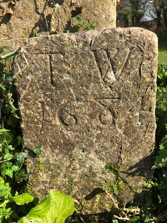
T. W.
1 6 8 4
This limestone boundary stone stands In a field to the east of Lower Farm, currently owned by Christ Church, in the south-east corner of the former Barton Farm. This may be the important boundary established in 1298 that marked the division between the Manor of Headington and the Forest of Shotover.
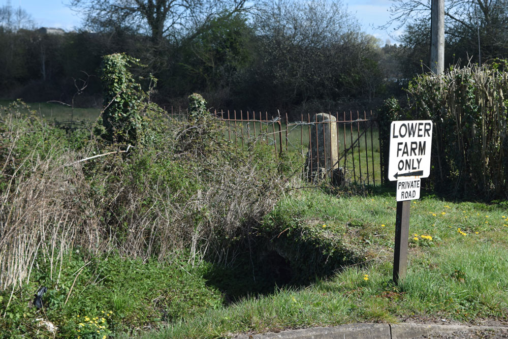
The stone is opposite the bottom end of Barton Village Road before it swings right (very near the signpost to Lower Farm). It is adjacent to the north side of the Bayswater Brook, roughly in the centre of this map, which shows the area both at the end of the nineteenth century and today, and just to the right of the ancient bridge that crosses the Bayswater Brook immediately to the west.
Grade II listed:
List Entry 1485757
This stone is not marked on old Ordnance Survey maps. Next to it are a large old stone gatepost and another smaller stone.
Until 1881 the boundary of Headington curved north to include Barton Farm and Wick Farm. It was only in that year that the boundary was moved southwards, but although this land thenceforth came under Stowood (now Beckley & Stowood), it continued to be considered part of Headington.
When this stone was set up in 1684 the Whorwoods were Lords of the Manor of Headington, and the letters T. W. on this stone are likely to stand for Terra [land] Whorwood. Brome Whorwood died in the year the stone was erected, and his daughter Mrs Diana Masters took over as Lady of the Manor, followed after her death in 1701 by his illegitimate son Thomas Whorwood.
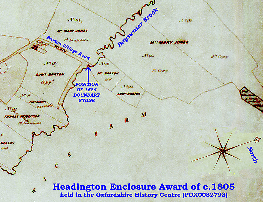
The 1802–5 Enclosure Award map (relevant extract below: whole map here) shows clearly that the boundary of the Manor of Headington and Wick Farm was then opposite the bottom of Barton Village Road and just on the north side of the Bayswater Brook, which is exactly where this stone is situated:
There was a change in the ownership of the adjacent Wick Farm not long before this boundary stone was erected, when Unton Croke junior (who had been Sheriff of Oxfordshire in 1658 and MP for Oxford in 1669 and was the son of Unton Croke of Marston) became the owner. In 1687 Croke sold the farm to Sir William Walter (c.1635–1693), 2nd Baronet Walter of Sarsden. Anthony Wood wrote in his diary (Vol. III, p. 246):
In the winter time this yeare, 1687, Sir William Walter of Sarsden bought of Unton Croke the farme in Hedington parish called "The Wyke." Unton Croke changed Mert. Coll. lease at Chetwood in Bucks with ...., bart, for the Wyke post annum 1665.
This extract from the Will of Francis Godfrey dated 1736 confirms that part of the Manor of Headington was on the north side of the Bayswater Brook:
Also I give devise and bequeath to my said Brother in Law George Smith and my Nephew Francis Godfrey all those my three Closes of meadow ground and three Lays of pasture ground Lyeing above the Brook in Headington mead aforesaid which I hold by Coppy of Court Roll of Thomas Whorwood Esquire Lord of the said Manor To hold to my said Brother in Law George Smith and my Nephew Francis Godfrey and their Heires for ever according to the Customs of the said Manor
(The Thomas Whorwood who is mentioned there had succeeded to the Lordship of the Manor of Headington in 1736 and was the grandson of the earlier Thomas Whorwood mentioned above.)
The other two stones in this Barton group
The photograph below shows the group of three stones.

The second small stone on the right is illegible, but it could be older than the dated stone and is possibly marking the boundary of the Royal Forest of Shotover and Stowood as perambulated in 1300.
The tall stone behind the 1684 boundary stone appears to be an ancient gatepost, as it has a pintle in its base.
The photograph below shows the ancient stone bridge that once led to a route to the farm (still faintly visible here on GoogleEarth) through a gate that would have hung from the surviving stone gatepost on the right.

The field
The stones are in a field measuring 4 acres 1 rood and 36 perches at the bottom of the lane (now part of Barton Village Road) that led down from the hamlet of Barton across the Bayswater Brook to Barton Farm (see 1900 map):
In 1935 the Oxford Preservation Trust bought this field in order to protect it from Ernest William Gurden, who ran Barwick Nurseries here. In October 2022, however, the Trust announced that they had sold this field to Christ Church, which originally planned to put a road through the exact part of the field where this stone stands for buses to reach their proposed large development on the land north of Bayswater Brook.
On 17 April 2023 the 1684 stone in this field became protected by Grade II listing , with the following consequences:
- On 30 May 2023 Christ Church & Dorchester Residential Management submitted planning application P23/S1832/LB to South Oxfordshire District Council seeking to relocate the listed stone to make way for the new road, but this was WITHDRAWN in September 2023.
- On 17 August 2023 they amended the main planning application P22/S4618/O to include an alternative bus route, leaving the bridge and stones in situ.
The photograph below shows the current position of the stones (over the ancient grassy bridge and behind the metal fence) in relation to the Bayswater Brook and the entrance to Lower Farm to the west: